

Interactive Radar Information System
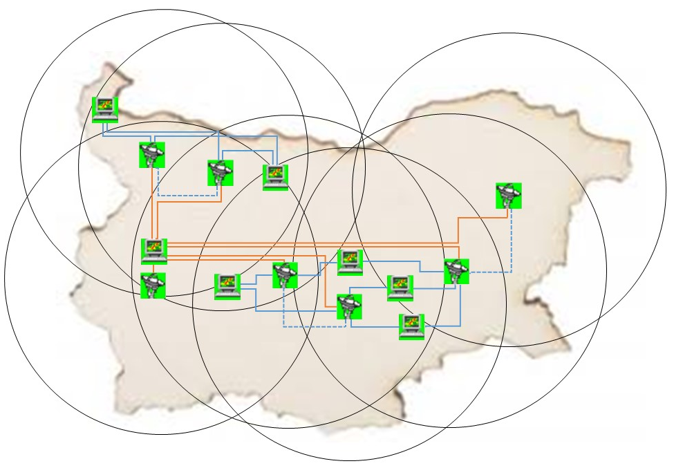
The system includes 8 MRL-IRIS radar stations, located in command posts of: regional directorate: the village of Golyam Chardak, District of Plovdiv; the village of Popovitsa, District of Plovdiv; the village of Dolno Tserovene, District of Montana; the village of Bardarski geran, District of Vratsa; the village of Staro selo, District of Sliven; Meteorological radar center in the village of Yarlovo, District of Sofia, the town of Shumen, Dolni Dabnik.
The radars (S-band) are modernized MRL-5 stations with Doppler transmitters and IRIS system of Sigmet-Vaisala. MRL-IRIS is a modern Doppler radar system for automatic volumetric scanning of the atmosphere and data archiving. Real time volumetric radar information is transmitted to other command posts and the information center in Sofia.
The information received from the seven radars is processed in real time and transmitted to users.
IRIS-Analysis
Radar meteorological information
| COMP – composite product of data from the three radar stations (CAPPI, TOPS, SRI, RAIN1, SHEAR) | |
|---|---|
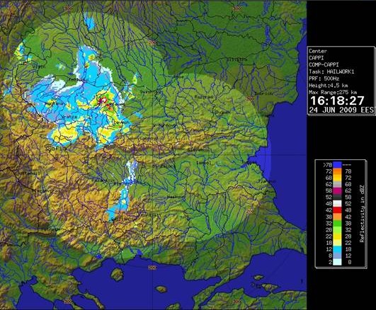 |
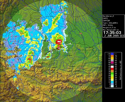
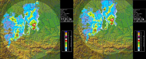
CAPPI (Constant Altitude Plan Position) The product displays the radar reflectivity on a selected constant height. There is visualization for a single radar. |
 |
TOPS The TOPS product is a display image of the height of the highest occurrence of a selectable threshold dBZ contour. There is visualization for a single radar. |
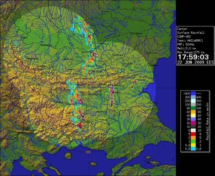 |
SRI (Surface Rainfall Intensity) The product shows the Surface Rainfall Intensity as relationship between the radar reflectivity and rain intensity Z=aRb is used. There is visualization for a single radar. |
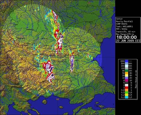 |
RAIN1 The product obtains an estimate of the hourly rain and displayed results. There is visualization for a single radar. |
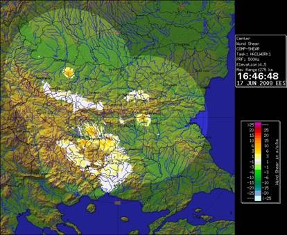 |
SHEAR The SHEAR product can detect wind shear in the atmosphere. The high values of wind shear used for indication of variety of dangerous phenomena: tornado, microbursts, etc. |
|
Products for display of information from single radars in range 150 km. |
|
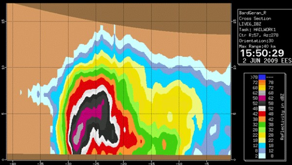 |
XSECT |
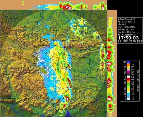 |
MAX The MAX product displays horizontal maximum projection. The product provides an easy-to-interpret presentation of the echo height and intensity of radar reflectivity in the clouds. The maximum of radar reflectivity is determined with horizontal and two vertical projections — East–West and North–South. |
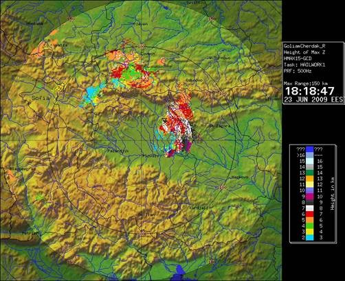 |
HMAX The HMAX product displays the height of the maximum reflectivity. |
 |
TRACK TRACK product shows the projected motion for storm features The TRACK product consists of a series of track points connected by lines, or “tracks.” |
 |
FCAST The product is used to project other products forward in time |
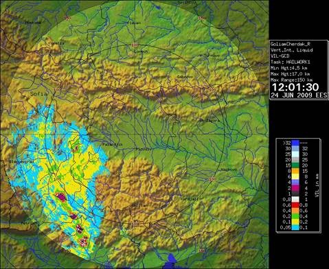 |
VIL (Vertically Integrated Liquid) |
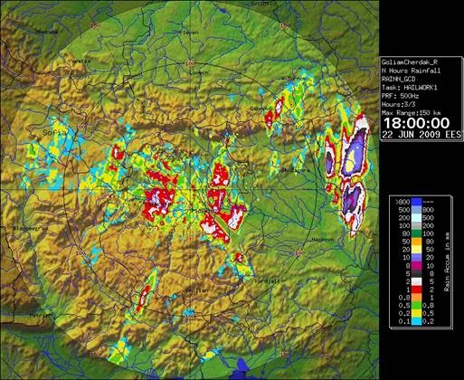 |
RAINN The IRIS product estimate rain quantity for the last N hours hourly rain and displayed results. |
 |
VVP (Velocity Volume Processing) The Velocity Volume Processing algorithm (VVP) obtains the following parameters averaged over a volume centered about the radar: • Horizontal wind speed and direction; • Horizontal divergence (related to vertical air motions); • Particle vertical velocity (airspeed and particle fallspeed combined) • Horizontal deformation and axis of dilatation (related to frontal forcing) • Average reflectivity |
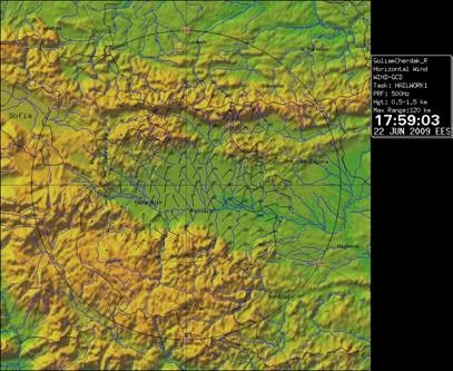 |
WIND The WIND product computes the horizontal wind vectors (the horizontal wind field) using the radial velocity information. |
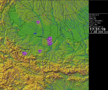 |
WARN The product provides warning of dangerous weather phenomena as hail, floods, lightning, turbulence, etc.) |
IRIS-Display
Radar meteorological information
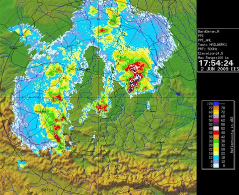 |
PPI The PPI product shows the distribution of the radar reflectivity on a constant elevation angle surface — the classic radar display. |
|
XSECT |
|
HMAX The HMAX product displays the height of the maximum reflectivity. |
|
WARN The product provides warning of dangerous weather phenomena as hail, floods, lightning, turbulence, etc.) |
|
TRACK TRACK product shows the projected motion for storm features The TRACK product consists of a series of track points connected by lines, or “tracks.” |
|
FCAST The product is used to project other products forward in time. |
IRIS-RADAR
Radar meteorological information
|
PPI The PPI product shows the distribution of the radar reflectivity on a constant elevation angle surface — the classic radar display. |
|
XSECT |
|
HMAX The HMAX product displays the height of the maximum reflectivity. |
|
WARN The product provides warning of dangerous weather phenomena as hail, floods, lightning, turbulence, etc.) |
|
TRACK TRACK product shows the projected motion for storm features The TRACK product consists of a series of track points connected by lines, or “tracks.” |
|
FCAST The product is used to project other products forward in time. |